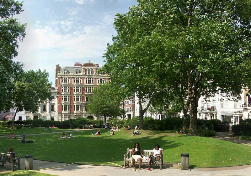
Showing posts with label square. Show all posts

Friday, December 08, 2006

Parliament Square - London

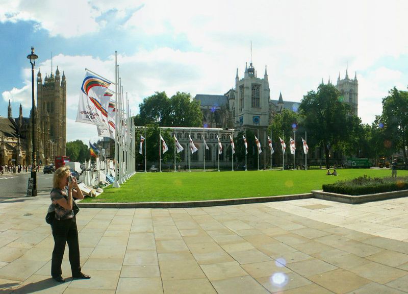
Parliament Square with 2012 Olympic flags and Brian Haw anti war protest

This photo of the view of Parliament Square in London is part of one of the panoramic images found on the PanoramicEarth.com Tour of London. There are over 100 images taken from around London linked to an interactive map.

Plan your visit to London by taking advantage of these London Hotel Specials or Thomson City Breaks. Get the most of London with these London Guide Books

Parliament Square is, as the name suggests, just outside Parliament and the Palace of Westminster. The square is surrounded by official and imposing buildings including Westminster Abbey and St. Stephens Tower (containing the bell Big Ben). Also here is Protcullis House containing the offices for many of the MPs, completed in 2001.

Parliament Square has often been used as a platform for protest or publicity. Here the two collide as the banners, erected during the 2012 London Olympic bid promote the event, while along the ground are the posters and placards erected in support of Brian Haw and the peace protest against the War in Iraq. The latter are not welcome by the establishment and in May of 2006 the police removed most of it in a late night operation. Ironically, this action was overseen by a statue of Winston Churchill, defender of British freedoms, which is being photographed by the lady in the foreground.

Equally ironic is the proposal for a statue of Nelson Mandela, another champion of freedom, to be placed in the square. One can only speculate about his opinion of the State’s treatment of the current protest there. There is also a statue of Abraham Lincoln in Parliament Square.

The effectiveness of the Brian Haw protest (virtually unbroken since 2001) resulted in a new clause being introduced into the Serious Organised Crime and Police Act of 2005 banning all forms of public protest from the square without permission from the police. It is really difficult to imagine how this protest in Parliament Square constitutes a serious organised crime, but it is evident that people in power do not want him there.

Parliament Square has often been the destination for marches protesting or demonstrating in London for one thing or another. It was ‘reclaimed’ in May 2000 by the Reclaim the Streets protest group and turned into allotments. Other notable protests to focus on Parliament Square include those in opposition to the War in Iraq in 2003, and the Countryside Alliance in opposition to the ban on fox hunting.

Parliament Square became surrounded by traffic in 1926, and is now very busy almost all the time. During New Years Eve it is filled with people waiting for Big Ben to bring in the new year, and often now caught in the midst of firework displays from the London Eye and the Thames.

Over 200 Destinations with HotelConnect.

The nearest tube stations include Westminster and St. James Park.

The full panoramic image taken from the junction of Parliament Square can be found on the London tour by PanoramicEarth.com. An enlargement of this photo can be found on Flickr. You can also find a marker for Parliament Square on Tagzania.

For more articles on London see the London Index or select one of the labels at the bottom.

Tuesday, December 05, 2006

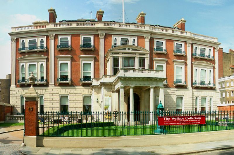
Wallace Collection in London

Wallace Collection in Manchester Square

This photo of the view of The Wallace Collection in London is part of one of the panoramic images found on the PanoramicEarth.com Tour of London. There are over 100 images taken from around London linked to an interactive map.

Plan your visit to London by taking advantage of these London Hotel Specials or Thomson City Breaks. Get the most of London with these London Guide Books

The Wallace Collection started life as a private collection built up during the 18th and 19th centuries by the Marquesses of Hertford. The final collector was Sir Richard Wallace, the son of the 4th Marquess. Upon his death his widow, Lady Wallace, donated the entire collection to the nation in 1897. Hertford House, the former London residence of the Wallaces, was converted into a museum and the collection was opened to the public in 1900.

Among the more famous pieces is The Laughing Cavalier by Hals, and works by Titian and Rembrandt. The Wallace Collection also contains a large number of 18th Century French wokrs including paintings, porcelain, furniture and gold boxes. Together this is reputed to be one of the largest collections of French works outside of France. However, the Wallaces did not stop there and you will also find British arms and armour as well as other European and Oriental objects.

Thankfully, entrance to the Wallace Collection is still free, and the central courtyard to the house was given a glass roof a few years ago so visitors will not be caught out in the weather. Unfortunately, the same can not be said for Manchester Square, on which the Wallace Collection is located just off Oxford Street, which is kept under lock and key for the use of the surrounding residences only.

Over 200 Destinations with HotelConnect.

The nearest Tube stations the Wallace Collection are Bond Street and Marble Arch on Oxford Street, though Baker Street is not too far away.

The full panoramic image showing the front of Hertford House and Manchester Square can be found on the London tour by PanoramicEarth.com. An enlargement of this photo can be found on Flickr. You can also find a marker for the Wallace Collection on Tagzania.

For more articles on London see the London Index or select one of the labels at the bottom.

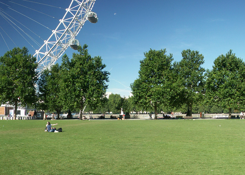
Jubilee Gardens - London

Jubilee Gardens next to London Eye

This photo of the view of Jubilee Gardens in London is part of one of the panoramic images found on the PanoramicEarth.com Tour of London. There are over 100 images taken from around London linked to an interactive map.

Plan your visit to London by taking advantage of these London Hotel Specials or Thomson City Breaks. Get the most of London with these London Guide Books

Jubilee Gardens is a new open space in London next to the London Eye, overlooking the Thames in the London Borough of Lambeth. The gardens were created in 1977 to mark the Silver Jubilee of Queen Elizabeth II, and were opened by the Queen on 9 June of the same year. As such, the gardens form part of the Jubilee Walk, which takes in various locations around London.

As mentioned, Jubilee Gardens are close to the London Eye, one of the most popular tourist attractions in London, and also close to the London Aquarium (free entrance with the London Pass), the Salvador Dali Exhibition and a short distance from where the steps from Westminster Bridge descend to the South Bank. Hungerford Bridge also crosses the Thames next to the park providing aceess to Embankent and Charring Cross. In the summer it is a great place to relax and watch the crowds bustle past along the South Bank while the London Eye continues it’s slow and graceful rotations.

At present, Jubilee Gardens is a grassed area surrounded by trees and overseen by local community groups and businesses. Following local consultation in December 2004 it was decided to turn the area into a park and the Jubilee Gardens Steering Group was formed to oversee the project. Four designs were short listed from a competition of ideas for the space and were presented to the public in May of 2005. In June 2005 it was announced that West8 have been selected to take their concept forward.

West8 sees Jubilee Gardens as ‘an holistically-designed, organic, lush and green park’, and plan an undulating area set with curved paths and raised lookout points. It will be planted with a variety of trees and flowers providing blooms throughout the year. Based on a ‘metaphor of Green Trafalgar’, it will transform Jubilee Gardens from a plain flat area into a dynamic and varied open space. More information can be found on the Jubilee Gardens website. In May 2006 Lambeth Council granted planning permission for the project to proceed, but as yet there is no date set for the commencement of the works which will probably see Jubilee Gardens close for several months.

Over 200 Destinations with HotelConnect.

The nearest Tube stations to Jubilee Gardens include Waterloo, Westminster and Embankment

The full panoramic image taken of the Jubilee Gardens can be found on the London tour by PanoramicEarth.com. An enlargement of this photo can be found on Flickr. You can also find a marker for Jubilee Gardens on Tagzania.

For more articles on London see the London Index or select one of the labels at the bottom.

Thursday, November 30, 2006

Grosvenor Gardens - London

Grosevenor Gardens and Statue of Cheetah chasing Gazelle

This photo of Grosvenor Gardens in London is part of one of the panoramic images found on the PanoramicEarth.com Tour of London. There are over 100 images taken from around London linked to an interactive map.

Plan your visit to London by taking advantage of these London Hotel Specials or Thomson City Breaks. Get the most of London with these London Guide Books

Grosvenor Gardens is split into two tiny triangles, Upper Grosvenor Gardens and Lower Grosvenor Gardens. They are both found just over the road from Victoria Train Station and are surrounded by busy roads at the rear of Buckingham Palace gardens. The ‘squares’ get their name from the Grosvenor family, who own much of Mayfair and Westminster, and also built Grosvenor Square.

Grosvenor Place, a very busy road, runs past Grosvenor Gardens and up the rear wall of the Buckingham Palace gardens to Hyde Park Corner. Buckingham Palace Road, running along the bottom of Upper Grosvenor Gardens, will take you to the Victoria Memorial front of the Palace, St. James Park and Green Park.

Lower Grosvenor Gardens, being nearer the station, is more used by the public and has more seating in it. They are very busy in the summer lunch hour when workers from the surrounding offices pour into the area. At other times you will find travelers waiting for their trains and buses, as well as a fair number of others sleeping and waiting for, well, probably nothing.

Upper Grosvenor Gardens is quieter with a more formal laid out lawn and planting area. As can be seen in this image, there is a fantastic statue of a cheetah chasing a gazelle leaping out of the flowerbed. If you need to arrange a place to meet someone, then Upper Grosvenor Gardens, though a little further from the station, is a more relaxing place.

Over 200 Destinations with HotelConnect.

The nearest tube station is Victoria.

The full panoramic image taken of Upper Grosvenor Gardens can be found on the London tour by PanoramicEarth.com. An enlargement of this photo can be found on Flickr. You can also find a marker for Upper Grosvenor Gardens on Tagzania.

For more articles on London see the London Index or select one of the labels at the bottom.

Grosvenor Square - London

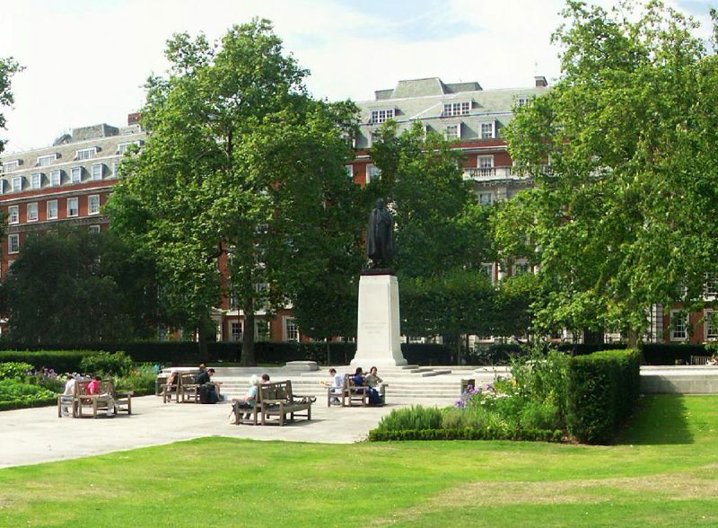
Grosevenor Square and Statue of Roosevelt

This photo of Grosvenor Square and the Statue of Roosevelt in London is part of one of the panoramic images found on the PanoramicEarth.com Tour of London. There are over 100 images taken from around London linked to an interactive map.

Plan your visit to London by taking advantage of these London Hotel Specials or Thomson City Breaks. Get the most of London with these London Guide Books

Grosvenor Square is an important square in the centre of London, mostly know now for the presence of the United States Embassy that sits at the west end of the square. Grosvenor Square sits in the middle of Mayfair, and, with Berkley Square, is one of the two large squares in the area. You can find Grosvenor Square on Tagzania, pinned to a map of London.

Grosvenor Square is in fact oval and the footpaths arch in from the corners to the centre in graceful curves. Towards the north side is a statue of Franklin D. Roosevelt from which a broad walkway runs directly to the south side. This is a pleasant area to sit in the summer, south of Oxford Street and away from the bustling shoppers.

The square was developed by Sir Richard Grosvenor in 1710. The Grosvenor family have long been important to this and the surrounding areas; the Dukes of Westminster all come from the Grosvenor family and own a huge percentage of the surrounding land of both Mayfair and Westminster. . Building around the square finished in 1727 and 0f the 51 people who took up residence here over the next 20 years some 35 were titled, with 16 peers, 2 dukes, 9 earls, and a scattering of dukes, duchesses and knights. Up to WWII, Grosvenor Square was considered to be one of the 3 most desirable locations in London to live, and, as can be seen, many of the aristocracy did so. Few, if any, of the original buildings survive.

The American Embassy was established in Grosvenor Square in 1938, and many of the houses swiftly became occupied by staff and military personnel associated with the embassy. Because of this American presence, Grosvenor Square was chosen as the location for the British memorial to F.D. Roosevelt, which was unveiled by Mrs. Roosevelt in April 1948. At the same time the current layout of the square was established, with many old trees and other plantings being removed.

Not everyone is happy now at sharing the square with the American Embassy, for the embassy remains a prime potential target for terrorist attack and, in spite of the huge amount of security, the price of the surrounding properties have been hit somewhat, much to the chagrin of their wealthy occupants.

There is an interesting fact about Mayfair, the name comes from a 2-week long fair that used to be held in the area in May between 1686 and 1764. It was then banned and moved out of the area. It is somewhat surprising that there has not been a move to reclaim the event for the area, though I suspect that hosting the fair in Grosvenor Square would not be acceptable to the American Embassy.

Over 200 Destinations with HotelConnect.

The nearest tube stations are Bond Street and Marble Arch on Oxford Street, though Green Park is also fairly close.

The full panoramic image taken of Grosvenor Square can be found on the London tour by PanoramicEarth.com. An enlargement of this photo can be found on Flickr.

For more articles on London see the London Index or select one of the labels at the bottom.

Monday, November 27, 2006

The Walk, Gray's Inn Gardens - London

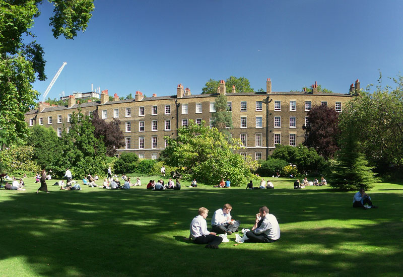
Lawyers eating lunch in Grays Inn Fields in London

This photo of Grays Inn Gardens in London is part of one of the panoramic images found on the PanoramicEarth.com Tour of London. There are over 100 images taken from around London linked to an interactive map.

Plan your visit to London by taking advantage of these London Hotel Specials or Thomson City Breaks. Get the most of London with these London Guide Books

The Walks of Gray’s Inn Gardens is an open space next to Gray’s Inn, bordered by Theobalds Road to the north and Gary’s Inn to the east. Like any other open square or park, they are very popular with workers from the surrounding area during lunchtime in the summer. For the visitor too they make a good place to relax for a while before continuing to explore the surrounding areas.

Gray’s Inn, with which this field is associated, is one of the four Inns of the Court around the Royal Courts of Justice, and a home of barristers. The other Inns are Lincoln’s Inn, Inner Temple and Middle Temple. These legal quarters date back to the 14C, and is a place of training and support for lawyers.

The Gardens are officially known as The Walks, and were laid out by Sir Francis Bacon (who courted, but never gained, the favour of Queen Elizabeth I) near the end of the 1500’s. Records from 1597 show it was: 'ordered that the summe of £7. 15s. 4d due to Mr Bacon, for planting of elm-trees in the walkes, be paid next term'. In the following year more trees were planted at the cost of £60. 6s. 8d'. Unfortunately the construction of the Raymond Buildings and the Verulam Buildings destroyed both his mount and flower garden respectively, but much of the rest still remains. The man in charge of The Walks is known as the Mater of the Walks.

Gates dating 1723 lead into The Walks from Field Court, and remind all that the area is open to members, to the public during the summer, and never to dogs. On the gate posts are mounted griffons bearing the shields of the Inner Temple. The main feature of The Walks is the broad gravel path that runs North-South from Thoebalds Road down an avenue of mature trees. Set off on either side of this avenue are plantings of flowers and ornamental shrubs.

As well as being a location of Lawyers, Gray’s Inn also contains a Great Hall, the location for students to eat and often the location of plays and other entertainment. Gray's Inn became famous for dancing, masques, river pageants, revels and plays. Queen Elizabeth herself was the Grays Inn's Patron Lady and in 1594, under the patronage of Henry Wriothesley, Shakespeare put on his Comedy of Errors within the Hall.

Over 200 Destinations with HotelConnect.

The nearest tube stations are Chancery Lane and Russell Square. The British Museum and Brunswick Gardens are also close by.

The full panoramic image taken of the The Walks in Gray's Inn Gardens can be found on the London tour by PanoramicEarth.com. An enlargement of this photo can be found on Flickr.

For more articles on London see the London Index or select one of the labels at the bottom.

Sunday, November 26, 2006

Eccleston Square - London

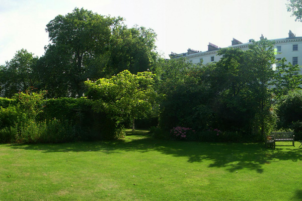
Eccleston Square, near Victoria Station, London

This photo of Eccleston Square in London is part of one of the panoramic images found on the PanoramicEarth.com Tour of London. There are over 100 images taken from around London linked to an interactive map.

Plan your visit to London by taking advantage of these London Hotel Specials or Thomson City Breaks. Get the most of London with these London Guide Books

Eccleston Square lies just s short distance away from Victoria Station, it is a private square accessible only by those inhabiting the residences that line the square. There is very little information available about the history and the origin of the square available, and, unless you are inclined to climb the spiked fence, no public access.

Eccleston Square is notable for those institutions that occupy some of the surrounding buildings. Here you will find the London arm of the Passport Office (89 Eccleston Square), and the regular queues of people frantically trying to get rapid processing of lost, stolen or expired documents just before they go on holiday.

The Catholic Agency to Support Evangelisation (CASE) have their office at Number 39, having changed their name, after 100 years, from the Catholic Missionary Society. Other notable institutions around the square include the headquarters of the Buddhist Society (58 Eccleston Squar), which moved here in 1956, the year of the 2,500th celebration of the Buddha Jayanti, or the Buddha’s Enlightenment celebrations in India. At 32 Eccleston Square you will find the Garden Design department of the Inchbald School of Design.

You can find Eccleston Square on Tagzania

The nearest Station to Eccleston Square is Victoria Station.

Over 200 Destinations with HotelConnect

The full panoramic image taken from the top of Rose Gardens can be found on the London tour by PanoramicEarth.com. An enlargement of this photo can be found on Flickr

For more articles on London see the London Index or select one of the labels at the bottom.

Tuesday, November 14, 2006

The Rose Garden, Queen Mary Gardens, Regents Park

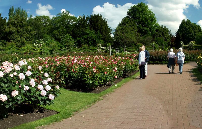
Roses in flower in the Queen Mary’s Rose Garden in The Regents Park in London

This photo from the Queen Mary’s Rose Garden in Regents Park, London is part of one of the panoramic images found on the PanoramicEarth.com Tour of London. There are over 100 images taken from around London linked to an interactive map.

Plan your visit to London by taking advantage of these London Hotel Specials or Thomson City Breaks. Get the most of London with these London Guide Books

The Rose Garden is part of the Queen Mary’s Gardens in The Regents Park. In fact many people refer to the whole of the Queen Mary Gardens as the Rose Gardens, though this is incorrect. Within the gardens are nearly 330 different varieties of roses, all planted out with labels indicating what they are. As such this Rose Garden should be a one stop reference point for those interested in roses.

In fact the list of plants here is impressive: There are 84 Formal Beds containing 80 varieties of Roses and a further 145 varieties are in the borders. The Rose Gardens also contains some 60 varieties of rambling or climbing roses, 41 varieties of Patio (miniature) Roses giving a total of 326 varieties and over 15,000 plants.

The focal point of the Rose Garden is the Rose Wheel, the circular area shown in this photo. A series of 10 planted beds radiate out from a focal bed, and are further surrounded by 10 other more rectangular planting beds. Around the whole of this are a number of benches set into alcoves formed by climbing roses. From the air the Rose Wheel takes on the appearance of a crop circle. Yet this is by no means the ends of the Rose Garden More beds of roses are spread out along and around the main lake within Queen Mary’s Gardens forming a glorious display of colour and smells. Put together this is a very popular place where people stroll gently or simply sit surrounded by flowers.

The Queen Mary’s Gardens occupy the whole of the 18 acres surrounded by the Inner Circle. The Inner Circle was first leased to the Royal Botanical Society and used as their garden. In 1932 the lease ran out and the garden was taken over by the Royal Parks and renamed as the Queen Mary’s Garden, after the wife of King George V. Here you will find a National Collection of delphiniums, herbaceous and Mediterranean borders, extensive lawns, an alpine island on the lake and, in the summer, a begonia garden and a sub-tropical border. The Queen Mary’s Gardens are also home to the Open Air Theatre and Garden Café.

Regents park is very close to Baker Street and many people walk through it from here to London Zoo. From Baker Street you will enter the park at the Boating Lake, and then you can cross a bridge, proceed up the path to Queen Mary Gardens. Another formal gardens within the Regents Park is Avenue Gardens.

Over 200 Destinations with HotelConnect

The full panoramic image taken from the top of Rose Gardens can be found on the London tour by PanoramicEarth.com. An enlargement of this photo can be found on Flickr.

For more articles on London see the London Index or select one of the labels at the bottom.

Finsbury Circus - London

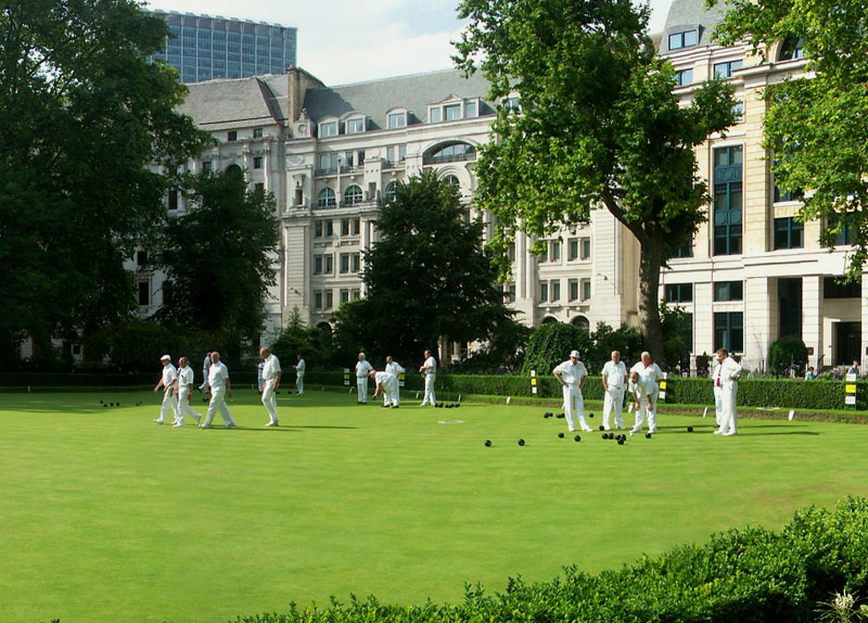
People playing bowls in Finsbury Circus in the City of London

This photo of Finsbury Circus is part of one of the panoramic images found on The London Map from Panoramic Earth. There are over 100 images taken from around London linked to an interactive map.

Plan your visit to London by taking advantage of these London Hotel Specials or Thomson City Breaks. Get the most of London with these London Guide Books

Full 360° Panorama of Finsbury Cirus

Finsbury Circus is tucked away in the near to the City of London and definitely not on the beaten track for those visiting London. It is unusual in more ways than one. Unlike many other squares in London this one is elliptical, and in the centre is an immaculate bowling green used by the City of London Bowls Club, as evidenced by the people in white shown in this picture. The nearest Tube Station is Mooregate and it is also near to the Museum of London.

Finsbury Circus is a quiet place to let time pass in the summer. Much of the square is occupied by the bowling green, but there is plenty of seating area around this and some beautiful planted areas. While this image shows the bowling green, the full panoramic image also shows the bed behind where the plantations form the crest for the City of London. Finsbury Circus also contains a band stand and it is not uncommon to hear live jazz or other music drifting across the square in the summer.

The history of Finsbury Gardens goes back a long way, to Roman times, when the area, known as ‘Fesnbury’ and effectively a moor. In the early 15C the city wall was breached at this point and nearby Moorgate was completed. By the early 17C the area had been raised and planted with trees becoming a public park, the first in London, in 1606. The land of Finsbury Circus was acquired by the Corporation of London in 1900 and the bowling green laid in 1904.

None of the buildings around Finsbury Circus are original (William Montegue built some fine houses here around 1815), but those that do now surround the oval square are graceful curved terraces typically occupied by banks, insurance companies and the like. The HQ of British Petroleum is also currently located on Finsbury Circus.

An enlargement of this photo can be found on Flickr.

For more articles on London see the London Index or select one of the labels at the bottom.

Victoria Embankment Gardens - London

Victoria  Embankment Gardens next to Embankment Tube Station

This photo of The Victoria Embankment Gardens is part of one of the panoramic images found on the PanoramicEarth.com Tour of London. There are over 100 images taken from around London linked to an interactive map.

Plan your visit to London by taking advantage of these London Hotel Specials or Thomson City Breaks. Get the most of London with these London Guide Books

The Victoria Embankment Gardens are a lovely place to relax and have a picnic in the summer months when the sun is out and the plantations within the gardens are in bloom. This stretch of green nestled between Charring Cross and Embankment stations and running along the River Thames. The Gardens contain several notable statues and other features and also hosts free concerts, weather permitting, during the summer. The Victoria Embankment Gardens, being close to the aforementioned stations, are also close to the Strand, taking just a couple of minutes for a shopper to get to and escape the crowds.

The development of the Embankment was proposed by Sir Christopher Wren after the Great Fire of London, but took until 1862 for a scheme to be approved. At that time the embankment wall along the Thames was built, constructed of bricks and faced with granite the wall extends some 4m below the low water mark of the river and allowed for some mud flats to be reclaimed. The embankment wall also prevented flooding of the city.

The whole of the Victoria Embankment Gardens is broken into 3 sections covering 11 acres, with the one shown here being the largest. The main historical feature of the Gardens is the Water Gate, a triumphal entry to the Thames built for the Duke of Buckingham in 1626. The Gate used to access the Thames directly, but because of the construction of the Embankment, it now stands some 100m from the edge of the river.

The Victoria Embankment Gardens, like any well presented public park, also contains a number of statues of note worthies from times past. Included among the collection here are both statues of the Scottish Poet Robert Burns, and a statue of William Tyndale who first translated the Bible into English in 1484 and was promptly executed for doing so. This statue dates from 1884. Other little treats within the Embankment Gardens include a water fountain dedicated to Henry Fawcett by ‘his grateful country women’ and a soldier mounted on a camel next to the band stand dedicated to the Imperial Camel Corps.

Just on the opposite side of the River to the Embankment Gardens is the London Eye and London Aquarium (entrance free with The London Pass). The Embankment Gardens are also very close to Westminster Pier, a major departure point for ferries and tour boats on the Thames.

Over 200 Destinations with HotelConnect.

The full panoramic image taken of the Victoria Embankment Gardens can be found on the London tour by PanoramicEarth.com. An enlargement of this photo can be found on Flickr.

For more articles on London see the London Index or select one of the labels at the bottom.

Monday, November 13, 2006

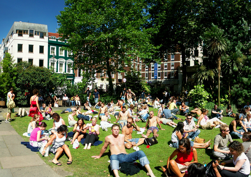
Soho Square - London

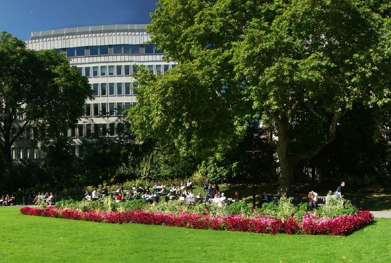
Soho Square in London filled with people

This photo from Soho Square, London is part of one of the panoramic images found on the PanoramicEarth.com Tour of London. There are over 100 images taken from around London linked to an interactive map.

Plan your visit to London by taking advantage of these London Hotel Specials or Thomson City Breaks. Get the most of London with these London Guide Books

Soho Square is, as can be seen from this photo, very popular in the summer when almost every square millimeter of grass is occupied for about 2 hours when the workers in the surrounding offices in Soho come out for lunch. Since Soho contains a vast number of firms that deal with all aspects of film and advertising (Soho is said to be the advertising capital of Europe) and is also home to the Football Association, there are plenty of takers for the lawns of the Square.

Soho Square is tucked away in a corner of Soho and is actually quite easy to miss all together. It is separated from both Oxford Street and Charring Cross Road by buildings (which insulate the square from the noise of the traffic) and linked to them by short narrow streets. Thus while Oxford Street can be 2 miles of pressed bodies shuffling toe to heal in search of bargains, drop off into Soho Square and you can forget what all the shoving was about.

Soho Square began life in 1681 when Kemps Field was developed by Richard Firth, originally called Kings Square after Charles II, and containing a statue of the King. At this time it was a fashionable and expensive place to live (now Soho is a fashionable and expensive place to have a business). Charles II had an illegitimate son (by his mistress Lucy Walter), the Duke of Monmoth, who lived in Kings Square. The Duke had a habit of shouting ‘So Ho’ whenever he went hunting or into battle and the name of the square changed to Soho Square in the popular mind.

Soho Square was also very popular with Dr. John Snow who famously linked the cholera of 1854 in Soho to the water pump located in Broad Street through epidemiology. Dr. Snow is often regarded as one of the founding fathers of epidemiology and the John Snow memorial pump still stands in Broad Street. It is said that Soho Square was one of his favorite places.

Over 200 Destinations with HotelConnect

The nearest tube station to Soho Square is Tottenham Court Road.

The full panoramic image taken of Soho Square can be found on the London tour by PanoramicEarth.com. An enlargement of this photo can be found on Flickr.

For more articles on London see the London Index or select one of the labels at the bottom.

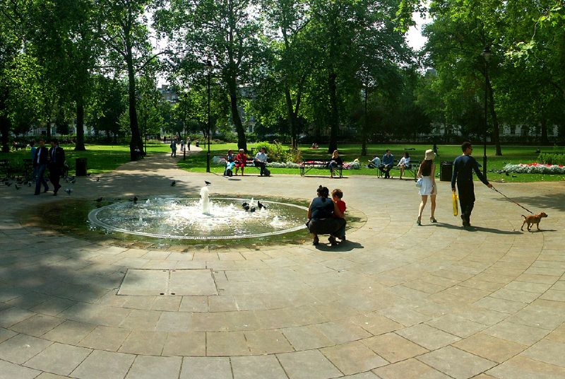
Russell Square - London

Fountain in Russell Square in London

This photo from the Russell Square, London is part of one of the panoramic images found on the PanoramicEarth.com Tour of London. There are over 100 images taken from around London linked to an interactive map.

Plan your visit to London by taking advantage of these London Hotel Specials or Thomson City Breaks. Get the most of London with these London Guide Books

Russell Square is a large open space in Bloomsbury, a part of the Borough of Camden in London. Russell Square is a haven of peace in the midst of a very busy area, close to the British Museum and British Library. The square forms a sort of huge roundabout and is constantly surrounded by traffic. Yet in spite of this, it is easy to come to the centre of the square and relax a little.

This has been greatly helped by a refurbishment project carried out by Camden Council in 2001/2, during which Russell Square was returned to the original 19C layout after years of neglect. One advantage of the oversight was that the square is now full of many mature trees, but the rest of the square had, until 2002 gradually fallen into disrepair and become an unsafe and unsavory place. Thankfully this is no longer the case and Russell Square, with a playful fountain at the centre and many seating areas, is once again popular.

On the northeast corner of Russell Square is a small green hut. This is in fact a Grade II listed building, on of only 13 shelters used by the drivers of the Hackney Carriages and dates from the late 1800’s. The east side of Russell Square is dominated by the Russell Hotel, built in 1900 and probably one of the finest Victorian hotels still standing.

Like many places in London, Russell Square derives it’s name from the family that developed it, in this case the Russell family were the Dukes of Bedford who developed this area in 17th and 18 century, at the same time that they developed Covent Garden and Tavistock Square nearby. Russell Square used to be part of the gardens of the Duke’s London home, Bedford House (one has to wonder just how big these gardens were).

Russell Square was developed for the gentry in 1806, with large terraced houses some of which still survive on the southern and western sides. A blue plaque shows that T.S.Elliot worked in Russell Square for many years as the poetry editor of Faber & Faber. The building is now occupied by the School of Oriental and African Studies (part of the University of London). Other famous occupants of the square include the English Painter Thomas Lawrence (many of his paintings can be found in the Waterloo Chamber at Windsor Castle).

Russell Square is just a short walk away from the British Museum and the British Library. Great Ormond Street Children’s Hospital is near by, and the nearest shopping area is the Brunswick Centre. The nearest tube stations include, naturally, Russell Square, and Euston.

Over 200 Destinations with HotelConnect

The full panoramic image taken or Russell Squaer can be found on the London tour by PanoramicEarth.com. An enlargement of this photo can be found on Flickr.

For more articles on London see the London Index or select one of the labels at the bottom.

Thursday, November 02, 2006

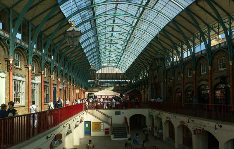
Covent Garden - London

Covent Garden in London

This photo of Covent Garden in London is part of one of the panoramic images found on the PanoramicEarth.com Tour of London. There are over 100 images taken from around London linked to an interactive map.

Plan your visit to London by taking advantage of these London Hotel Specials or Thomson City Breaks. Get the most of London with these London Guide Books

Covent Garden has to be one of the most famous shopping and café areas in London, located just north of the Strand and south of Neal Street. In and around Covent Garden you will find numerous shops and markets. Both the London Transport Museum and the Theatre Museum are close to Covent Garden, while the Royal Opera House is just around the corner.

You can find lovely pictures of Covent Garden taken from the air in Jason Hawke’s book London from the Air.

When most people talk of Covent Garden the first thing that tends to spring to mind is the square or Piazza. This is laid out in an Italian fashion. In the centre is a covered market area with some sunken shops. Often you can catch the chords of classical music being played by buskers as you browse the stalls. At either end are open air performers entertaining the gathered crowds. Human statues line the path from Covent Garden Tube station to the piazza itself waiting to be given coins which prompt sudden movement. In addition to all this, Covent Garden also contains some fairground rides.

When you get tired of browsing the market stalls and other shops, you will be spoilt for choice for a place to sit down, as Covent Garden is lined with various bars, cafes and restaurants. The Royal Opera House contains a café that actually overlooks Covent Garden providing a view of the top of the market and the people bustling around.

The name ‘Covent Garden’ comes from 'convent garden', and refers to the gardens of the Abbey or convent of St Paul. This 40 acre garden was established in the 12C by King John and played a role in providing not only Westminster Abbey, but also much of London, with fresh food for the next 300 years. This all came to an end under Henry VIII and in 1552 the land then known as “le Covent Garden” was granted by Royal patent to the Earl of Bedford in perpetuity.

Covent Garden began to take it’s present form by the 19C, and in 1973 was saved by complete redevelopment after a huge public outcry which resulted in many of the buildings, including the covered market area, receiving listed status.


Over 200 Destinations with HotelConnect

The full panoramic image of the west end of Covent Garden showing the inside of one of the covered market areas, can be found on the London tour by PanoramicEarth.com. An enlargement of this photo can be found on Flickr.

For more articles on London see the London Index or select one of the labels at the bottom.

Tuesday, October 31, 2006

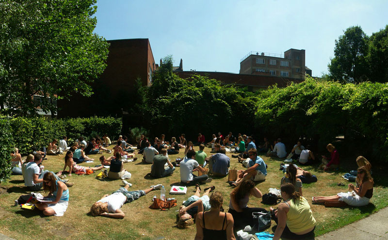
Colville Place - London

Colville Place off Tottenham Court Road near Goodge Street in Lodon

This photo of Colville Place in London is part of one of the panoramic images found on the PanoramicEarth.com Tour of London. There are over 100 images taken from around London linked to an interactive map.

Plan your visit to London by taking advantage of these London Hotel Specials or Thomson City Breaks.

Colville Place is found just before Goodge Street when traveling North up Tottenham Court Road. It is quite small, contains a grassy area, a couple of walkways under arches created by plants and various seating. The area around Colville place is packed with shops and offices.

Tottenham Court Road is well known for HiFi and computer shops that dominate the bottom end of the street. The top end contains more furniture shops than anything else, though this is liberally sprinkled with numerous eateries, unfortunately mostly of the chain brand variety, to satisfy the lunchtime demands of the offices nearby. Colville Place can thus make a welcome break for a place to rest one’s feet from trudging through the shops, although the sound of Tottenham Court Road is never far away.

In the sum, therefore, the time at which this picture was taken, the grass of Colville Place may be all but invisible at lunchtime due to the people crammed into almost every available space.

The one place of note that is on Colville Place is the Colville Place Gallery, the only gallery in the Uk dedicated to Digital Art. It is located at 1 Colville Place and has a changing display of up and coming artists working with the new media. The Colville Place Gallery has a reputation that far outstrips the size of the building, and also contains a fair collection of Digital Art Books and DVDs about the subject.

The nearest tube station to Colville Place is Goodge Street.

Over 200 Destinations with HotelConnect

The full panoramic image of Colville Place can be found on the London tour by PanoramicEarth.com. An enlargement of this photo can be found on Flickr.

For more articles on London see the London Index or select one of the labels at the bottom.

Cavendish Square off Oxford Street - London

Cavendish Square in London

This photo from Cavendish Square in London is part of one of the panoramic images found on the PanoramicEarth.com Tour of London. There are over 100 images taken from around London linked to an interactive map.

Plan your visit to London by taking advantage of these London Hotel Specials or Thomson City Breaks.

Cavendish Square is not that well known. It is just north of Oxford Street in London and close to Oxford Circus. Surrounded by shopping and offices it is popular with workers as a lunch spot during the summer. In fact, it makes for a pleasant break from the bustle and crowds that weave their way along Oxford Street. John Lewis shopping centre borders the south side of Cavendish Square, and it is often much easer to exit the store here than through the front onto Oxford Circus.

As for a little history, Cavendish Square was first developed in 1717 by the 2nd Earl of Oxford for his wife Henrietta Cavendish-Hollace. Oxford Street itself was also being redeveloped at the same time. The square became very fashionable among the upper classes in London, with individuals like the Duke of Chandos choosing to build there. However, the South Sea Bubble burst and a lot of people lost money, including the Duke of Chandos who had to settle for something rather less grand than originally planned.

Cavendish Square became well known from references to it in books by Charles Dickens, including Nicholas Nickleby, Lottle Dorrit¸and Barnaby Rudge. The square is occupied by statue of both William (Duke of Cumberland who defeated the Bonnie Prince Charles at the battle of Culloden) and Lord George Bentinck (Conservative MP of late 19C).

The whole area is also famous for private medical practices, with both Harley Street and Wimpole Street being near by. Cavendish Square was also the home of Heythorp College until the price of staying here became prohibitive and the college moved out in 1993. Unfortunately, the installation an underground car park and enhancement of vehicle access around the square in the 1970’s has destroyed much of the original layout.

The nearest station to Cavendish Square is Oxford Circus.

Over 200 Destinations with HotelConnect

The full panoramic image of Cavendish Square can be found on the London tour by PanoramicEarth.com. An enlargement of this photo can be found on Flickr.

For more articles on London see the London Index or select one of the labels at the bottom.

New Panoramas on Panoramic Earth