Showing posts with label roman. Show all posts

Friday, October 14, 2011

The Best Roman Palace in the World

If you are interested in seeing the most complete Roman palace in the whole world, then you need to head for Split, a port town on the Dalmatian coast of Croatia. There you will find Diocletian's Palace, built in the 4th century for the Roman Emperor as a retirement home.


Some home - containing army barracks, imperial quarters and servant sectors, the walled compound was capable of housing several thousand people. Central to the complex was the Emperors mausoleum, now Split Cathedral. While there, climb up the Bell Tower for fantastic views over the palace and rest of the city, as shown below.


Friday, October 13, 2006

Circus Maximus - Rome

Circus Maximus - Rome

This photo of the Circus Maximus is part of one of the panoramic images found on the PanoramicEarth.com Tour of Rome. There are over 100 images taken from around Rome linked to an interactive map.

Full 360° panorama of the Circus Maximus

Unfortunately there is very little remaining of the Circus Maximus in Rome, very well known as the location of the chariot race in Ben Hur. It was far too convenient to plunder the building materials for other projects so this is now an open area used for walking dogs. It is a pitiful end to an arena which in it’s day could seat around 300,000 people, with almost the same number viewing from the surrounding hills.

There is evidence to suggest that the area of the Circus Maximus was first used by the Etruscan kings as a place for games as far back as 600 BC. It continued to be associated with public events and in 50 BC Julius Caesar expanded the arena. In 81, the Senate built a triple arch honoring Titus by the closed East end (not to be confused with the Arch of Titus on the opposite side of the Palatinum Hill near to the Colosseum and Roman Forum).

This was made for chariot racing, the track is about 600m long and 80m wide and could hold 12 chariots at a go. The two sides of the track were separated by a spina (spine) that ran down the center. At each end was a meta, a turning post the chariots would career round at dangerous speeds. The number of laps was marked by rotatable metal dolphins set along the top of the spina. The spina also supported various statues and Augustus placed an obelisk here (moved to Piazza del Popolo by pope Sixtus in 16C).

It is hard to imagine the chaos and confusion that must have resulted during the race, and the best depiction is probably still the chariot race in Ben Hur. Only one of the 12 chariots would survive the race, the others crashing at some point throughout. There was a dedicated crew whose only job was to remove the remains of ruined chariots and the dead and injured people and animals from the track without becoming track-kill themselves.

This image is taken from the lookout on the Via del Circo Massimo. Behind the Circus Maximus you can see the Palatine Hill and the ruins of Domitian’s Palace. Further panoramas from Rome are on PanoramicEarth.com. An enlargement of this photo can be found on Flickr.

For more articles on Rome see the Rome Index or select one of the labels at the bottom.

Temple of Romulus - Roman Forum

Temple of Romulus - Roman Forum

This photo of the Temple of Romulus is part of one of the panoramic images found on the PanoramicEarth.com Tour of Rome. There are over 100 images taken from around Rome linked to an interactive map.

Full 360° panorama of the Temple of Romulus

One of the most amazing things about the Temple of Romulus is the door. This is not just a green door, or even a green bronze door. This door dates from the late Imperial Age and is therefore almost 1,700 years old. To have survived intact for so long and through so much is almost unprecedented. This is one special door.

But enough about the door, what about the rest of the building? It is situated in the Roman Forum next to the Temple of Antonius and Faustina, and dates from the early 4C. Originally it was thought that this was dedicated to Emperor Romulus who died in 307. Recently it has also been suggested that the building may have been associated with the Temple of Jupiter or the audience hall of a city prefect.

Maxentius bagan building the Temple of Romulus, and it was completed by Constantine. That is in such good condition is thanks in part to the fact that in the Middle Ages it was incorporated into the atrium of the church of St. Cosma and St. Damiano. Inside the church is a 6C mosaic showing Jesus Christ surrounded by several saints at his second coming. The rest of the church has taken over the Forum Pacis built by Emperor Nerva.

Full panoramic images from the Roman Forum are found on the Rome tour by PanoramicEarth.com. An enlargement of this photo can be found on Flickr.

For more articles on Rome see the Rome Index or select one of the labels at the bottom.

Thursday, October 12, 2006

San Lorenzo in Miranda - Roman Forum

San Lorenzo in Miranda, formerly the Temple of Antonius and Faustina - Roman Fourm

This photo of the San Lorenzo in Miranda is part of one of the panoramic images found on the PanoramicEarth.com Tour of Rome. There are over 100 images taken from around Rome linked to an interactive map.

Full 360° panorama of San Lorenzo in Miranda

San Lorenzo in Miranda (aka: Temple of Faustina and Antonius) is found in the Roman Forum about half way along the Sacra Via. This area is often full of people snaking their way along the paths behind tour guides waving various umbrellas and sticks in the air as group markers. The lines are so long that some guides have resorted to wireless headsets to communicate, meaning that those at the end must surely by one or two sights behind the current commentary.

San Lorenzo in Miranda started off as the Temple of Antonius and Faustina, and is one of the best preserved temples in the Forum. It was built around 140 and dedicated to Empress Faustina and then to her husband Antonius Pius after his death in 161.

In may have become a church in 7C, and is thought to be the place where S Lorenzo (St. Lawrence) was sentenced to death during the persecution of Christians by Valerian in 258. He is often portrayed as being burnt alive in a gridiron and his death may have had a profound impact in Rome furthering Christianity. This persecution also resulted in the crucifixion of Sixtus II the bishop and pope of the time. The Miranda part of the name may be either recognition of a benefactor at the time, or a derivation of ‘admire’ referring to the view over the Forum from the top of the steps.

The front shows the original pagan dedication DIVO ANTONINO ET / DIVA FAUSTINAE EX S(ENATUS) C(ONSULTO) (to the divine Antoninus and the divine Faustina by decree of the Senate). This is very unusual for a converted temple, normally evidence of pagan worship was destroyed, and the columns show marks of chains which were at one time used to try to topple them. The reconstructed flight of stairs up the front of the church may allow access to the pronaos and the pillars, but access to the interior is from the rear, through the College of Chemists and Pharmacists.

Unfortunately the church is often closed, though if you manage to get inside (possibly from 10-12 on a Thursday) you will find a single nave under a white barrel-vaulted ceiling with 3 side chapels. Above the high altar is the Martyrdom of St Lawrence by Pietro da Cortona, painted 1636-1646. This is framed by an aedicula of four black marble columns.

Full panoramas from the Roman Forum are found on the Rome tour by PanoramicEarth.com. An enlargement of this photo can be found on Flickr.

For more articles on Rome see the Rome Index or select one of the labels at the bottom.

Wednesday, October 11, 2006

S Eugenio

Altar of S Eugenio in Rome

This photo of the S Eugenio is part of one of the panoramic images found on the PanoramicEarth.com Tour of Rome. There are over 100 images taken from around Rome linked to an interactive map.

My mode of transport in Rome was a cycle. This can be fantastic for getting around the city quickly, but the cobbles can play havoc with your rear. I came across the church of S Eugenio on the way back from the Galleria Nazionale d’Arte. The church is located near to the Via Flamina, which used to be one of the main arteries for travelers visiting Rome, ending at the Piazza del Popolo.

S Eugenio is a modern building, built under the orders of Pope Pius XII, who was christened Eugenio Pacelli, and dedicated to the patron saint of his name. Funds were raised from the gifts the pope had received from the Silver Jubilie of his episcopate (started in 1942), and the altar was consecrated in 1952.

S Eugenio is built in a Baroque style though with some updating. Above the altar is the in an alcove is a statue of the pope, which the face of the altar depicts the removal of Jesus from the cross. The church also contains some reasonable frescoes in some of the side chapels, especially in those dedicated to Sts Peter and Paul and the chapel of Our Lady at Fatima.

A full panoramic image showing the inside or S Eugenio’s is found on the Rome tour by PanoramicEarth.com. An enlargement of this photo can be found on Flickr.

For more articles on Rome see the Rome Index or select one of the labels at the bottom.

Colosseum - The Outside

Colosseum or Colisseum, the Flavian Amphitheatre in Rome

This photo of the Colosseum is part of one of the panoramic images found on the PanoramicEarth.com Tour of Rome. There are over 100 images taken from around Rome linked to an interactive map.

Even in a ruined state the Colosseum is impressive. A massive amphitheatre designed to hold some 50,000 people purely for the delight of seeing man and beast slaughtered in the sandy arena. Originally called The Flavian Amphitheatre after the Emperors of the Flavian family in Rome who built it, starting with Emperor Vespasian in AD 72. It was finished by Titus and the inauguration event involved a 100 day festival during which over 5,000 animals and 2,000 gladiators perished.

Although the structure is huge (an oval 188m long and 156m wide) the name comes from the Colossus of Nero, the largest bronze statue ever to have been built (it stood about 40m high) by the megalomaniac Emperor. It was transported here by 24 elephants after his death. It was then named after the sun god and the head was often changed to match the Emperor of the day. All that remains of it now is the base, fenced off near to the Arch of Constantine.

The Colosseum was partly built as a public relations exercise, the space it occupies used to be part of Nero’s private pleasure gardens, and Vespasian sought to gain favour by returning the site to the people. Building the largest amphitheatre in the world, right next to the Roman Forum, seemed like a good idea at the time. When constructed, the Colosseum originally stood in the middle of a lake.

Spectators would enter the Colosseum through one of 76 numbered entrances at ground level. Today these arches are locked with railings as shown here. Each ticket would specify the gate, tier and seat number and by all accounts ran much smoother than many large auditoria or football stadia do today. It was said that the 50,000 spectators could be seated within 10 minutes of opening up for the day. In fact all modern stadiums have copied the plan of the Colosseum to some degree.

Over time much of the stone work has been used for other projects, including St. Peter's Basilica in the Vatican. Nowadays a busy road runs around the Colosseum, but even this does not detract form the impact of the structure. Tickets to the Colosseum also allow entry to the Palatine Hill.

A full panoramic image showing the area around the Colosseum is found on the Rome tour by PanoramicEarth.com. An enlargement of this photo can be found on Flickr.

For more articles on Rome see the Rome Index or select one of the labels at the bottom.

Tuesday, October 10, 2006

Colosseum of Rome - Inside

The Colosseum, Rome, inside view of the amphitheatre.

This photo of the Colosseum is part of one of the panoramic images found on the PanoramicEarth.com Tour of Rome. There are over 100 images taken from around Rome linked to an interactive map.

Full 360° panorama of the Colosseum

The Colosseum is one of the most visited attractions in Rome. And this means that unless you get there early it will be full of people. Even though over half of the material that makes up the Colosseum has been plundered for other building works, the ruins are still very impressive. Be warned that if you see the queue outside the building then there are another 100m or so of queue within the outer ring of the Colosseum hidden from view! Tickets to the Colosseum also allow entry to the Palatine Hill, accessed through the Roman Forum.

The Coliseum was built by the Flavians, with work starting in AD72 and finishing in AD82. The inauguration of Titus in AD80 saw over 5000 wild animals and 2000 gladiators slain in during a 100 day festival. The Middle Ages saw the Colosseum become an informal quarry and stones were often used for other buildings, including parts of St. Peter’s Basilica.

The Coliseum is huge, an ellipse 188m long and 156 wide. Originally 240 masts were attached to stone corbels on the 4th level. From these a vast canopy could be extended to cover the whole amphitheatre if needed. It was used for the re-enactment of famous Roman battles, with gladiators saluting the emperor with 'Ave Caesar, morituri te salutant!' (Hail Caesar, those who are about to die salute thee!).

Entrance to the lower tier around the arena is through gates off to the right of this image. At points steep steps ascend to the upper tier from where this picture was taken. From this vantage point, at the end nearest the Roman Forum, you can clearly see the tunnels and works that rested under the arena floor from which animals and people entered the arena. Part of the arena floor has been reconstructed at the far end, and gladiators used to enter the arena through a gate just below the crowd of people in the foreground. The Imperial box was located at the mid point of the left hand side of the arena.

The most common spelling is "Colosseum", but search will quickly show that it seems that no two places spell it the same. Other variants include 'Coloseum, Colisseum, Colliseum, Colleseum, Colossium and Colissium'.

More panoramas of the Colosseum and the surrounding Roman Forum are on the Rome tour by PanoramicEarth.com. An enlargement of this photo can be found on Flickr.

For more articles on Rome see the Rome Index or select one of the labels at the bottom.

Trajan's Forum

Trajans Forum (Foro Triano) in Rome

This photo of the Trajan’s Forum is part of one of the panoramic images found on the PanoramicEarth.com Tour of Rome. There are over 100 images taken from around Rome linked to an interactive map.

Trajan’s Forum (sometimes call ‘Traiano’) lies in the centre of ancient Rome, just over the road form the Roman Forum and Colosseum. It is visited by far fewer people than the Roman Forum, but dodging traffic across the street is worthwhile. And for those concerned about road safety, the Italians have actually installed a pedestrian crossing, though whether the traffic adheres to the signals or not is a mute point.

Trajan’s Forum began life in 107 AD and is the grandest of the 5 Imperial Forums. Building it required the removal of two hill sides – the Quirinal and Capitoline (Campidoglio) Hills, which was no mean feat in a time without mechanical aid. It was intended to relieve overcrowding in the Roman Forum and to link southern Rome to the Campus Martius.

The forum was truly a masterpiece of construction became the sights of many noble acts including the releasing of slaves, burial of lists of state debtors and political prisoners, and the auction of the emperor’s personal treasures to raise money and avoid raising war taxes.

The forum measures 200m x 120m, along the far side is the Basilica Ulpia, a huge market place. Within four storeys almost anything from anywhere in the Empire was sold, wine and oil on first, spices and other imports on second, fresh fish in two ponds on fourth kept alive in ponds fed either with water from an aqueduct or sea water piped from Ostia. The third floor is thought to have contained the Congiaria, a kind of welfare office that distributed money and food to the needy.

The area owes its preservation to being converted in part to a convent, and in part to a fort. At one end stands Trajan’s Column and nearby are many important sites including the Roman Forum, Palatine Hill and Colosseum.

A full panoramic image is found on the Rome tour by PanoramicEarth.com. An enlargement of this photo can be found on Flickr.

For more articles on Rome see the Rome Index or select one of the labels at the bottom.

Palatine Hill - Stadium

Stadium on Palatine Hill

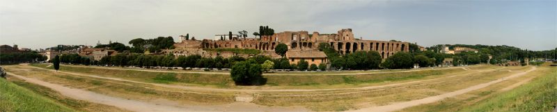
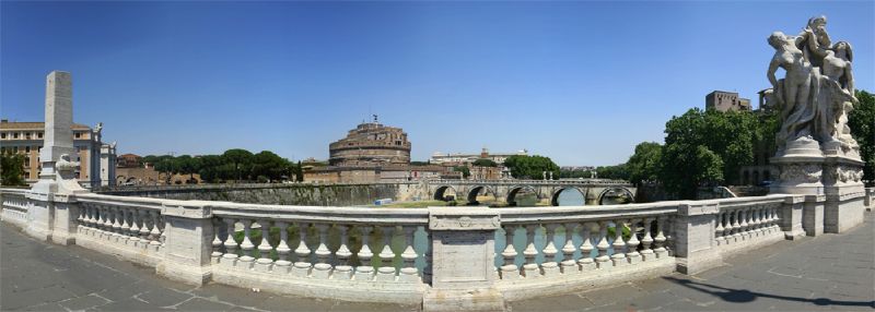
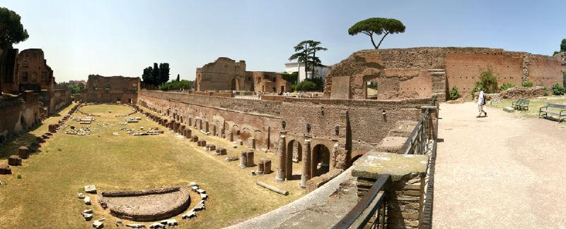
This view over the Stadium on Palatine Hill is part of one of the panoramic images found on the PanoramicEarth.com Tour of Rome. There are over 100 images taken from around Rome linked to an interactive map.

Full 360° panorama of the Domitian's Stadium

Palatine Hill is central, even foundational, to the history of Rome. It was here that, according to legend, Roma all began: Having been thrown over a bridge into the Tiber the twins Romulus and Remus were washed up onto the banks of the Palatine Hill and adopted by a she-wolf. The were suckled by the wolf and grew up in a cave in the hill. Later they were found and raised by a shepherd who was grazing sheep on the same hill as the wolf’s den. Remus and Romulus argued over where their city should be founded and Romulus won, killed his brother and started Rome on the Palatine Hill.

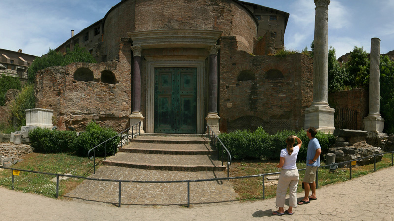
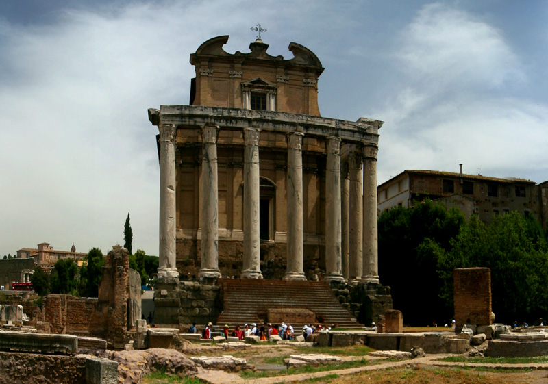
In reality the earliest archaeological findings are Iron Age huts from the 9C BC. The hill has been built up over time with one layer of buildings built upon another. The mound stands about 40m above the Roman Form and became a very desirable place to live with several Roman Emperors having palaces up here. Augustus was born here and lived in quite a modest home, which can not be said for the palaces built by Caligula, Tiberius, Nero and Domitian.

The most excavated areas on the hill include the Domus Augustana, Domus Flavia (home of Flavia, wife of Augustus), parts of Domitian’s Palace and the palace and baths of Septimius Servus.

Here you can see the Stadium, built at the same time as the Palace of Dimitian, possibly as a private garden, though it is thought that some horse racing may have occurred here. It is 160m long, well below ground level with semi-circular ends reminiscent of a hippodrome. Scattered around the Stadium are the remains of granite columns, a marble altar and various figures of gods.

Palatine Hill stands next to the Roman Forum and the Colosseum and yet, unlike the other two, it is not crawling with people even though it has some spectacular views to offer. Unlike the Roman Forum, entry to the Palatine Hill is not free, but the ticket also covers entry to the Colosseum. In fact getting your ticket to the Colosseum at the entrance to Palatine Hill can save quite a bit of time.

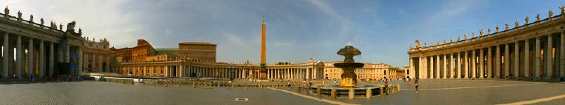
A full panoramic image showing the more of Domitian’s Palace is found on the Rome tour by PanoramicEarth.com. There is an enlargement of this Domitian's Stadium photo on Flickr.

For more articles on Rome see the Rome Index or select one of the labels at the bottom.

Piazza di Spagna - Barcaccia Fountain

Piazza di Spagna

This view of the Barcaccia Fountain in Piazza di Spagna is part of one of the panoramic images found on the PanoramicEarth.com Tour of Rome. There are over 100 images taken from around Rome linked to an interactive map.

The Piazza di Spagna is another place in Rome where people are not in short supply. Like the Pantheon and St. Peter’s it is difficult to find a time when there are not clusters of tourists following guides in and out of the square. The pace of life does not slow down in the night either, especially in the summer when people hang around the square talking and drinking.

The central piece to the square is the Barcaccia (Ugly Boat), a fountain set below ground level shaped from a leaking boat. Designed by either Pietro Bernini or his son, Gian Lorenzo, the fountain is sunk into the ground to compensate for the low water pressure Acqua Vergine. The inspiration for this design may have been a massive flood of the Tiber on Christmas day in 1598 which left a barge stranded in the city.

This image was taken from the base of the Spanish Steps (Scalinata della Trinita dei Monti to call them by their full name) which were built in 1723 to link Piazza di Spagna with the church at the top, the Trinita dei Monti, and the Pincio Hill.

Also in the square is the Keats-Shelley Memorial House where John Keats spent the last 3 months of his life. The square is linked to the Piazza del Popolo by Via del Babuino and surrounded by cafes and restaurants.

A full panoramic image showing the Spanish steps and the rest of the square is found on the Rome tour by PanoramicEarth.com. An enlargement of this photo can be found on Flickr.

For more articles on Rome see the Rome Index or select one of the labels at the bottom.

Monday, October 09, 2006

Pantheon in Rome

Pantheon in Rome - Inside

This view over the Pantheon is part of one of the panoramic images found on the PanoramicEarth.com Tour of Rome. There are over 100 images taken from around Rome linked to an interactive map.

Full 360° panorama of the Pantheon

The Pantheon survives virtually intact from ancient Roman times. It was originally dedicated to ‘all the gods’ – pan theon. The area in which it stands was a favorite Roman promenade filled with gardens and temples. The Pantheon we see today is the result of a building programme by Emperor Hadrian in 128 AD.

The survival of the Pantheon is credited, among other things, to two strokegs of fortune. It was the first pagan temple to be converted into a church, in 609, and in 734 pope Gregory III lined the roof with lead thus helping preserve it. However, the Pantheon, now dedicated to S Maria ad Martyres, did not survive unscathed and in 667 the Byzantine Emperor Constans II nicked all the bronze he could find in Rome including that lining the Pantheon to be melted down for coins in Constantinople.

However, when possible the popes always took care of this earliest church in Rome. The interior is stunning. Sunlight (and rain) pours through the oculus in the centre of a dome slightly larger than that at St. Peter’s. The interior is lined with lush marble and almost entirely intact in it’s original form except for the statues that used to line the alcoves. The bronze doors into the Pantheon were rebuilt by pope Pius IV in 1563, but later Bernini pillaged the bronze from the roof (again) to make the baldacchino at St Peter’s and 80 cannons for Pope Urban to install in Castel Sant’Angelo.

The Pantheon in Rome is hugely popular with tourists. Come here any time after 10am and you are likely not to be able to see the floor for the people, which is a shame as the marble floor is well worth it. In fact, all you will be able to see are groups of 100 or so people weaving their way among each other as they follow guides holding up umbrellas or poles with emblems on the top of them. Every so often a voice forlornly calls out in six or so languages urging people to be quiet. So if you actually want to see the Pantheon properly, then you have to get there when it opens.

Thus the part of the panoramic shown here was taken at around 8:30 in the morning when the place was relatively quiet and before trying to get quickly to St Peter’s for the same reason. The full panoramic image shown on the Rome tour by PanoramicEarth.com. For better appreciation of this image go to the collection on Flickr.

For more articles on Rome see the Rome Index or select one of the labels at the bottom.

Piazza Navona - Fountain of Four Rivers

Piazza Navona - Fountain of Four Rivers

This view over the Piazza Navona is part of one of the panoramic images found on the PanoramicEarth.com Tour of Rome. There are over 100 images taken from around Rome linked to an interactive map.

Full 360° panorama of the Piazza Navona

There are a few things that dominate the Piazza Navona of today. The first is the huge Fontana dei Quattro Fiumi in the centre of the long oval square topped with a large obelisk. The other is the shear number of cafés and restaurants that line the piazza. In this sense, the piazza almost feels like the Tardis from Dr.Who as it seems that surely there must be more seating space than the construction of the square could possibly allow for.

Piazza Navona started off life as the Stadium of Domitian, built in 85 AD to hold some 30,000 spectators, and the square still retains the original shape. Most of the streets lead into Piazza Novana where there were gates to the original stadium. Athletes used to enter along Via Agonale, and the area was known as Campus Agonis in the middle ages. From this through ‘in Agonale’ and ‘n’Agona’ the name ‘Navona’ is derived.

Piazza Navona fell into disrepair after the fall of the Roman Empire, decaying into use as a filed and vineyard until the 14C when it became a market place. The current form of the square developed under the orders of pope Innocent X, who also had the Pamphilj Palace built on the square for is family and personal use.

Fontana dei Quattro Fiumi or 'Fountain of the Four Rivers'
This is one of Bernini’s most famous works, along with the Piazza S Pietro in the Vatican. The base of the fountain holds four colossal statues representing four major rivers of the then known world:
Danube for Europe
Ganges for India
Nile for Egypt (with a covered face as the source of the river was not known at the time)
Rio della Plata for America.

Each figure is semi-prostrate before the obelisk places at the centre of the tower. This is meant to symbolize the then sovereignty of the pope over the temporal domains. The obelisk itself was made in Egypt for Demitian and started off it’s Roman career in the Circus of Maxentius on Via Appia, where, after the fall of Rome, it lay for centuries in five pieces before being moved here.

The image here shows two of the statues at the base of the fountain, and the hollow in the massive travertine rocks. In the 17C to 19C the piazza was regularly flooded by stopping up the fountain outlets and the people would play in the water. The full panoramic image shown on the Rome tour by PanoramicEarth.com. For better appreciation of this image go to the collection on Flickr.

For more articles on Rome see the Rome Index or select one of the labels at the bottom.

Friday, October 06, 2006

Pyramid of Gaius Cestius

Piramide of Gaius Cestius

This image of the Pyramid of Caius Cestius is part of one of the panoramic images found on the PanoramicEarth.com Tour of Rome. There are over 100 images taken from around Rome linked to an interactive map.

Full panorama of the Pyramid of Caius Cestus

Rome has a pyramid. This was a surprise to me as it may be to some of you. However, there it sits 37m high and incorporated into the Aurelian Walls just beyond the Porta San Paolo in the south of Rome. So how did a pyramid come to be in Rome? It is quite a Roman oddity being built by Gaius Cestius in 12 BC. Gaius Cestius was a wealthy Roman praetor and tribune of the people. He spent time in Egypt at the height of the Roman post-Cleopatra craze when, just like their European counterparts centuries later, the Romans were wondering off with huge obelisks like there was not tomorrow and immersing themselves into the Isis cult.

The pyramid is his tomb, is made of brick and then covered in white marble form Luni. It was reported to have taken 330 days to construct. Unlike many of the tombs for the Emperors which have crumbled to dust, this remains as intact as the day it was made. The original entrance is through an descending shaft half way up the north face. Excavations show that originally the interior was decorated with stuccoes and frescos of female figures, but these are very badly degraded and barely visible now. Outside the pyramid are two statue bases also dedicated to Cestius, though the statues themselves are long gone.

Nowadays the pyramid in adjacent to a very busy main road and while traffic speeds past on one side, the other forms part of the border to the Protestant Cemetery.

In this image you can see both the pyramid and the outside of the Porta San Paolo to the left. The full panoramic image showing views both up- and down-river is found on the Rome tour by PanoramicEarth.com. For better appreciation of this image go to the collection on Flickr.

For more articles on Rome see the Rome Index or select one of the labels at the bottom.

Ponte Rotto and Ponte Palatino

Ponte Rotto and Isola Tibernia from Ponte Platino

This image from Ponte Palatino is part of one of the panoramic images found on the PanoramicEarth.com Tour of Rome. There are over 100 images taken from around Rome linked to an interactive map.

Full panorama of the Ponte Palatino

This is a very wide angle view taken from the Ponte Palatino. The dominant area in the middle of the picture is the Isola Tiberina on which you will find the church of S Bartholomeo and the Ospedale Fatebenefratelli. The island is worth a visit as it is peaceful with few cars. To the left of the island, above the weir in the Tiber, is the Ponte Cestio linking the island to Trastevere.

The remains of an ancient bridge in the right side is of archeological interest. This is the sole remaining arch of the Ponte Rotto, which was the first stone bridge to span the Tiber. Originally the Ponte Rotto was called the Pons Aemilius, the pillars of this ancient bridge date from 179 BC, while the arches connecting them date from 142 BC. It was repaired several times from the 13C onwards until the final collapse in 1598, when it became known as the Ponte Rotto.

On the other side of Ponte Palatino, but not visible here, is the mouth of the largest sewer in ancient Rome, the Cloaca Maxima.

Ponte Palatino is an iron bridge resting on 4 stone pillars built between 1886 and 1890 designed by Vescovali. The name comes from the Palatine Hill nearby to the North. The bridge itself is not at all attractive, but offers a vital traffic link for Rome. It is the best place to see the Ponte Rotto and has pleasant views up the Tiber. It one of the longest bridge in Rome, measuring 155m.

The full panoramic image showing views both up- and down-river is found on the Rome tour by PanoramicEarth.com. For better appreciation of this image go to the collection on Flickr.

For more articles on Rome see the Rome Index or select one of the labels at the bottom.

Ponte Vittorio Emanuele

Ponte Vittorio Emmanuele in Rome

This image from Ponte Vottorio Emanuele II is part of one of the panoramic images found on the PanoramicEarth.com Tour of Rome. There are over 100 images taken from around Rome linked to an interactive map.

Full 360° panorama of the Vittorio Emanuele II bridge

The Vittorio Emanuele II bridge is a modern construction and is usually full of cars. It makes for the most direct link from the centre of Rome to the Vatican effectively joining the Corso Vottorio Emanuele with the Via De Conciliazione which then leads straight up to St. Peter’s Basilica. From here you can see up the river to the Ponte S Angelo and the Castel S Angelo, which are both in the background.

The Vittorio Emanuele II bridge was designed by Ennio De Rossi and opened on 5 June 1911, taking 25 years to build. The bridge has 3 arches and is 111m long and 20m wide. An 18th century building belonged to the Hospital Saint Spirit was destroyed during construction. It is a good example of the architecture of the time having four heavy allegorical sculptures situated over the central arch and four end pillars decorated with bronze Victories. The marble sculptures represent Liberty, Oppression defeated, Unity of Italy, and Loyalty to the Constitution.

The full panoramic image showing views both up- and down-river is found on the Rome tour by PanoramicEarth.com.. For better appreciation of this image go to the collection on Flickr.

For more articles on Rome see the Rome Index or select one of the labels at the bottom.

Porta Maggiore (Presentia) - Aqueducts of Rome

Porta Maggiore in Rome

This image from Porta Maggiore is part of one of the panoramic images found on the PanoramicEarth.com Tour of Rome. There are over 100 images taken from around Rome linked to an interactive map.

This gate is a short distance away from S Giovanni in Laterano. The metro station of Porta Maggiore is right in front of it, as is a main road. So getting photos of it without a tram or bus in the way can require some patience.

Porta Maggiore was not originally part of the city walls, and was not built to function as a gate, but as an aqueduct. Aqueducts are one of the things the Romans were famous for, then, as now the ever expanding city required more and more water than the local river Tiber could supply. The engineering feats of the aqueducts are now world famous.

Porta Maggiore contains 2 aqueducts, one on top of the other. The earliest one was started in the time of Caligula, and completed under Claudius in 52 AD. Aqua Claudia transported water from Subiaco about 70 km away while the Anio Novus aqueduct was even longer. The aquaduct was built in white travertine and contains inscriptions to Caludius, Vespasian and Titus.

Two important Roman Roads, the Via Prenestina and the Via Labicana, passed through the arches, and when the aqueduct was incorporated into the Aurelian walls in 271, this gate to Rome was known as the Porta Prenestina.

This image is taken from outside the walls. In front of the Porta Maggiore you can see a large travertine block carved with circles to represent bread pans. This is the Baker’s Tomb, built in 30 BC for Marcus Virgilius who baked bread for the state and may have invented the first mechanized dough mixer. He is depicted in a frieze on the tomb.

The full panoramic image showing more of the Aurelian Wall is found on the Rome tour by PanoramicEarth.com.. For better appreciation of this image go to the collection on Flickr.

For more articles on Rome see the Rome Index or select one of the labels at the bottom.

S Bonifacio e Alessio

S Alessio in Rome

This image from Santi Bonifacio e Alessio is part of one of the panoramic images found on the PanoramicEarth.com Tour of Rome. There are over 100 images taken from around Rome linked to an interactive map.

The name of this church is often abbreviated to S Alessio. It is named after Alexius who was killed by being pushed down some stairs. He was the only son of Euphemianus, a wealthy Christian Roman of the senatorial class. Alexius fled an arranged marriage to pursue his vocation, ending up in Edessa, Syria. Slaves were sent to look for him but did not recognize him living as a beggar.

Eventually he was singled out as a “Man of God” and fled back to Rome to live, unrecognized, with his parents who, as Christians, took him in for 17 years. He spent this time hiding under the stairs and teaching the faith to children. Documents found after his death revealed who he really was. A portion of a staircase is set into a 17C altar at the west end of the left aisle, supposedly the very one Alexius lived under.

Originally a home the site was converted into a church in 5C, but has undergone many revisions. The interior is painted in pastel colours and, while plain compared to many churches, has an airy and free feel to it. The façade is from 18C with 5 arches and a five-storey bell tower dating from 1217. The church also contains a well from the Alessio family and a Byzantine Madonna of the Intercession brought to Rome in the 10C.

The image here shows the main altar within the church. The full panoramic image shown on the Rome tour by PanoramicEarth.com.. For better appreciation of this image go to the collection on Flickr.

For more articles on Rome see the Rome Index or select one of the labels at the bottom.

San Bartolomeo all'Isola, Rome

San Bartolomeo all'Isola, Rome

This image from San Bartolomeo all’Isola is part of one of the panoramic images found on the PanoramicEarth.com Tour of Rome. There are over 100 images taken from aroundRome linked to an interactive map.

Tucked away on the Isola Tiberina, the small island in the Tiber in Rome, is the church of San Bartolomeo. The outside of the church is fairly plain and belies the beauty and depth of the interior, which is covered with expressive frescos. The church was built in 10C by the Holy Roman Emperor Otto III and originally dedicated to his friend Adalbert of Prague. However, once the possible remains of St. Bartholomew were interred here, the dedication and name of the church changed.

Like all places in Rome, church sites were often pre-occupied. This was originally the site of the Temple of Aesculapius, a Greek god of healing. The history here is that during a plague in Rome ambassadors went to the sanctuary of Asklepios in Greece and returned with a sacred serpent which escaped onto the island. Considering this pretentious, the Romans built the temple here and the island has been associated with healing ever since. The hospital of the Fatenefratelli is situated on the north end of the Island.

The image here shows the altar, which is actually a porphyry bathtub - one of the greatest status symbols an ancient Roman could hope to own. The relics of San Bartolomeo are buried beneath it. In front of the bath is the covered medieval well that may have been the source of the sacred spring used in the hospital. The chapel off to the right contains a fresco of Mary which dates back to the founding of the church. The full panoramic image shown on the Rome tour by PanoramicEarth.com. For better appreciation of this image go to the collection on Flickr.

For more articles on Rome see the Rome Index or select one of the labels at the bottom.

Rome - Thanks where it is due

Piazza S Pietro in Rome

It is one thing visiting a place and spending time taking lovely photographs. It is totally another to then try to remember where they all were or even what the places were called. I enjoy sites like Flickr, but so often title of ‘Church’ or ‘Statue’ does not really help in understanding where the image was taken. I like to have relevant titles on things, maybe that comes from my scientific training. I may even like to give a one liner (or more for the posts here) about them. It is at that time that I reach for the sources

In putting together the information on Rome I have used a number of sources. Among these are some travel guides, all of which contain both the same information and then separate snippets. These included guides from Cadogan, Eyewitness, Blue Guide and a Times Bartholomew Guide.

Naturally in addition to this the website has been an invaluable resource. I would like to thank all of those who have contributed to Churches in Rome on Wikipedia, and also the valuable information compiled on roma.katolsk.no, which is looks like being a very thorough personal labour of love. These are the kind of sites that deserve to be at the top of search engine results, far more than the ‘reviews’ given on travel sites.

In putting together the descriptions for both here and Panoramic Earth I have also gained far more understanding and appreciation for the places I have been to than if I were merely compiling a photo album.


S Bernardo Church Rome http://www.panoramicearth.com

Thursday, October 05, 2006

San Bernardo alle Terme

S Bernardo alle Terme church in Rome

This image from San Bernardo alle Terme is part of one of the panoramic images found on the PanoramicEarth.com Tour of Rome. There are over 100 images taken from around Rome linked to an interactive map.

Full 360° panorama of the church of S Bernardo alle Terme

The church of S Bernardo alle Terme is quite small and tucked away opposite S Maria della Concezione on the Via XX Septembre. The outside is painted a pastel pink colour. The church is circular in design, set into one of the circular halls that stood at the corners of the Diocletian Baths that may have been a temple. Unfortunately the area in front of the church has been converted into a very crowded and unattractive parking lot. Diagonally across the street is S Maria della Vittoria.

Built in 1598 it was given to a French Cistercian group called the Feuillants. San Bernardo alle Terme is similar in design to the Pantheon, being cylindrical with a dome and an oculus some 22m across. The dome decoration is made of octagonal coffers. The main focus of the interior are eight statues of saints housed in niches of the walls by Camillo Mariani. There are also two side altars dedicated to St Bernard and St Robert of Molesmes, co-founders of the Cistercian Order.

The German painter Johann Friedrich Overbeck who founded the Nazarene art movement, is interred here and off to one side is the Chapel of St Francis that was added to the ancient rotunda.

The image here is part of a panoramic showing the main altar flanked by the two side altars with 4 of the eight statues set into niches. The full panoramic image shown on the Rome tour by PanoramicEarth.com. There is a larger version of this image of S. Barnardo alle terme on Flickr.

For more articles on Rome see the Rome Index or select one of the labels at the bottom.

New Panoramas on Panoramic Earth